|
|
|
|
|
All pictures Copyright
E & BJ Capper Nagold 2013-15
|
|
|
|
|
|
|

|
7. - 10.10.2013
|
|
|
|
|
Aostatal
|
Aosta Valley
|
|
|
|
|
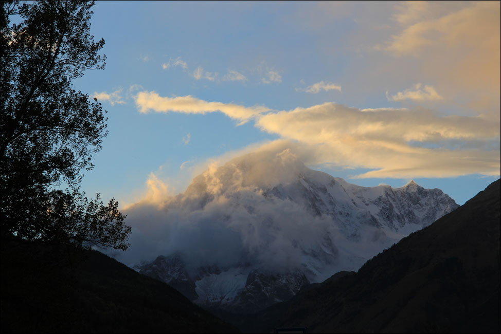
Zum Abschluss unserer Zeit in Italien verbringen wir wieder einige Tage in den norditalienischen Bergen. Nach der Überfahrt von Sardinien fahren wir zur nordwestlichen Ecke von Italien, zum obersten Ende des Aostatals. Man könnte es Im Schatten von Mont Blanc nennen, wenn nur die Sonne im Norden liegen wurde. DerMont Blanc, auf Italienisch Monte Bianco, ist mit 4810m der höchste Berg der Alpen.
Wir haben das Bergmassiv von Chamonix, Frankreich, aus gesehen und hier darüber berichtet.
Auf jeden Fall, wenn sich die Wolken etwas verziehen, ist der Mont Blanc vom Aostatal aus gesehen grandios.
|
To end up our time in Italy we spend a few days in the northern Italian mountains again. After the ferry crossing from Sardinia we drive to the north-west corner of Italy, to the upper end of the Aosta Valley. It could be called "in the shadow of Mont Blanc" if only the sun was in the north.
Mont Blanc, in Italian Monte Bianco, is at 4810m the highest mountain in the Alps.
We have seen the mountain starting from Chamonix, France, and wrote a report about it.
If the clouds allow it, you can get an impressive view of Mont Blanc from the Aosta Valley.
|
|
|
|
|
|
|
|
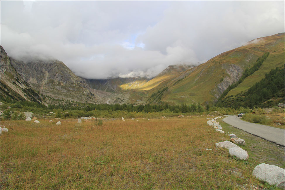
Wir erforschen drei der italienischen Täler, die wir in der Gegend von unserem schönen und zu dieser Jahreszeit fast leeren Campingplatz bei Morgex (Arc en Ciel = Regenbogen ) mit dem Campingbus erreichen können.
Das Tal mit dem Namen Val Ferret (nicht mit dem schweizerisches Val Ferret in Kanton Wallis zu verwechseln), liegt ausgestreckt in nordöstlicher Richtung von Entrèves, kurz vor dem Eingang zum Mont Blanc Straßentunnel.
Man kann eine gute Strecke in das flache Tal hineinfahren, aber niedrige Wolken machen die Landschaft für uns etwas ereignislos.
|
We decide to explore three Italian valleys that we can reach in our camper van. We start from our attractive camping site in Morgex, which at this time of the ear is almost empty, (Camping Arc en Ciel = "Rainbow"), .
The first valley is Val Ferret - not to be confused with the Swiss Val Ferret in the Canton of Valais. It stretches out in a north-easterly direction from Entrèves near the Italian end of the Mont Blanc road tunnel.
We drive for some distance into the flat valley, but the low clouds make for relatively uneventful scenery.
|
|
|
|
|
|
|
|
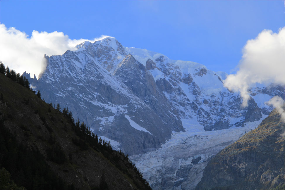
Auf der Rückfahrt werden wir durch einen schönen Blick hoch zur südöstlichen Flanke des Mont Blanc Massivs belohnt. Sie besteht hier aus dem Berg Grandes Jorasses mit seinem höchsten Gipfel Pointe Walker auf einer Höhe von 4208m.
|
On the return trip through the valley we are rewarded by a good view looking up at the south-east flank of the Mont Blanc massif. This part is the mountain Grandes Jorasses, with its highest peak Pointe Walker, 4208m .
|
|
|
|
|
|
|
|
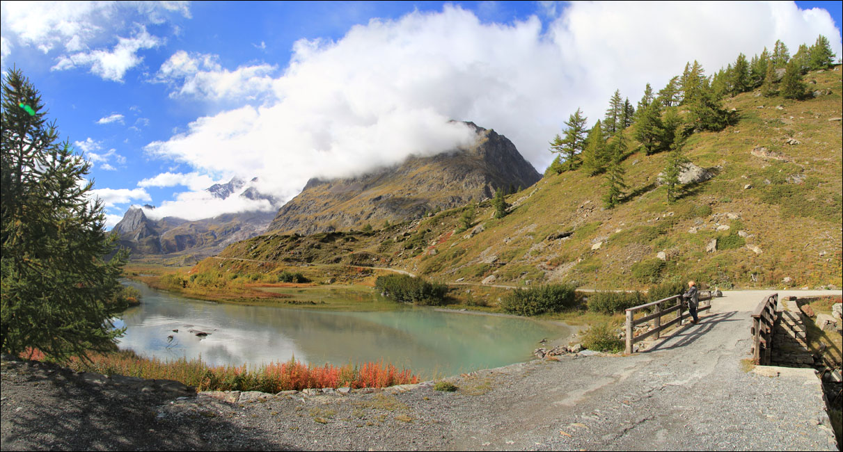
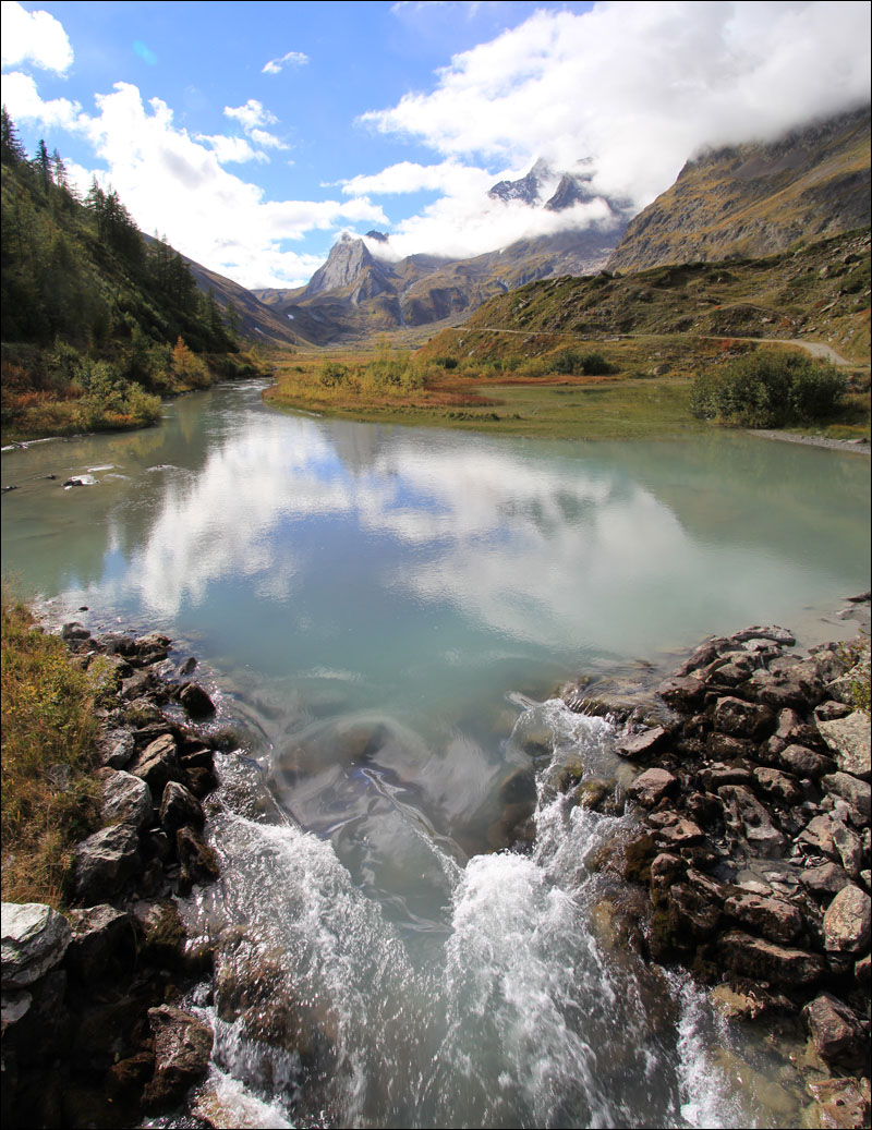
Ein weiteres Tal, Val Veny, setzt die Nordost/Südwest-Linie von Val Ferret auf der anderen Seite von Entrèves fort als Begrenzung des Mont Blanc Massivs.
Wir fahren dorthin und laufen das Tal entlang bis zu dem aufgestauten Fluss, der aus Lago Combal fließt.
|
Another valley, Val Veny, extends the east-west line formed by Val Ferret beyond Entrèves on the other side and borders the Mont Blanc massif.
We drive there and walk up the valley to the dammed-up river flowing out of Lake Combal.
|
|
|
|
|
|
Die Pyramides Calcaires in der Mitte spiegeln sich hübsch im Wasser.
Auf der rechten Seite oberhalb des Weges läuft die Moräne Miage. Dahinter ist es wohl nicht weit zum Lago del Miage, den wir leider nicht erreichen.
|
|
The Pyramides Calcaires in the middle reflect prettily in the water.
On the right side above the path is the Miage Moraine. Not far behind it lies Lago del Miage, which we unfortunately do not reach.
|
|
|
|
|
|
|
|
|
|
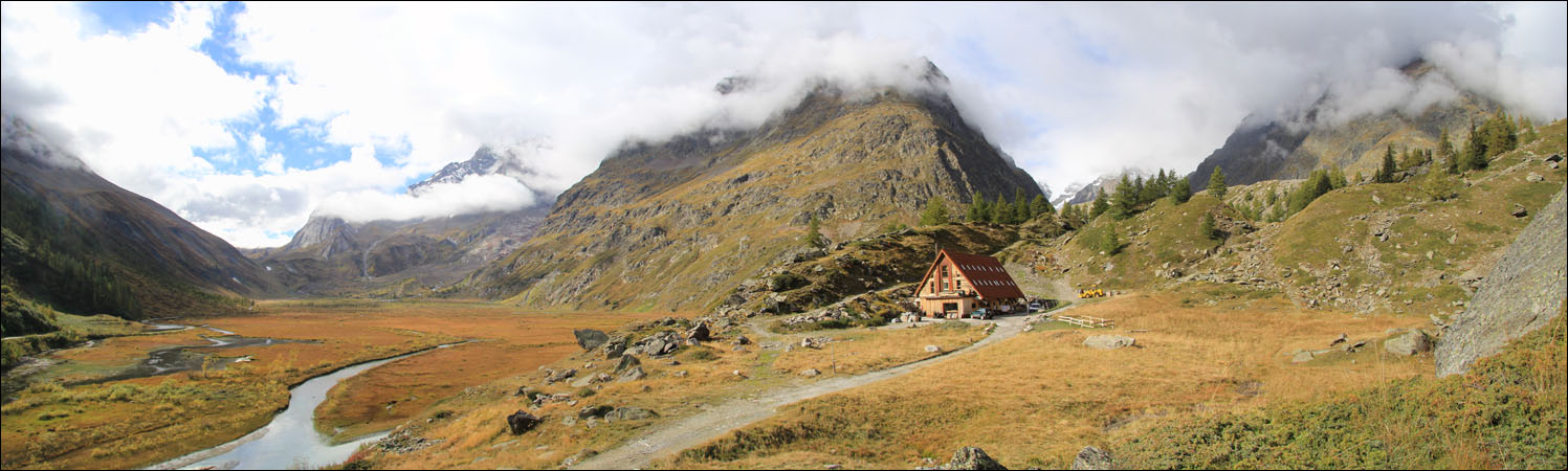
Bei der Ebene Plan Veny drehen wir um. Das hübsche Gebäude rechts ist der Ersatz für die bisherige Bar Combal. Leider waren die Bauarbeiten noch im Gange, sonst wären wir gerne dort eingekehrt.
Rechts hinter den Wolken liegt die Südwestflanke des Mont Blancs.
|
The level part of the valley is named Plan Veny and we turn back here. The attractive building on the right is the replacement for the previous Bar Combal. Unfortunately construction work is still in progress, otherwise we would have liked to try it out.
On the right behind the clouds is the south-western flank of Mont Blanc.
|
|
|
|
|
|
|
|
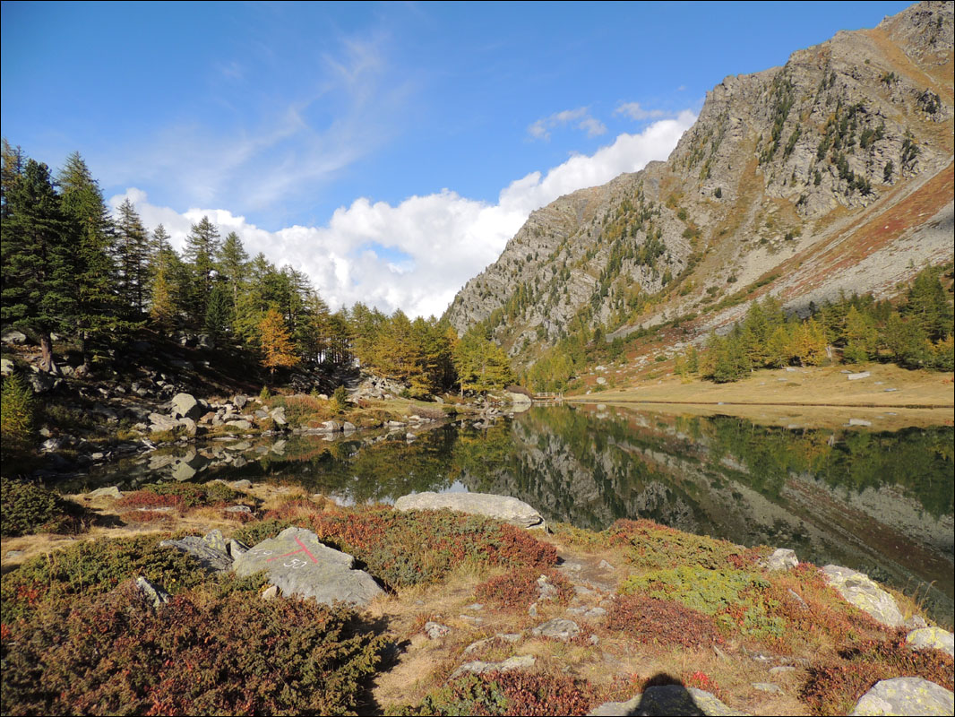
An einem anderen Tag nehmen wir die SR39 aus Morgex in südlicher Richtung und fahren hoch zur Colle San Carlo, auf einer Höhe von 1950m. Von dort aus laufen wir die schöne und leichte Strecke hoch zum Lago d Arpy bei 2066m.
|
On another trip we take the SR39 from Morgex to the south and drive up to Colle San Carlo at an altitude of 1950m. From there we walk the beautiful and easy route up to Lago d'Arpy at 2066m.
|
|
|
|
|
|
|
|
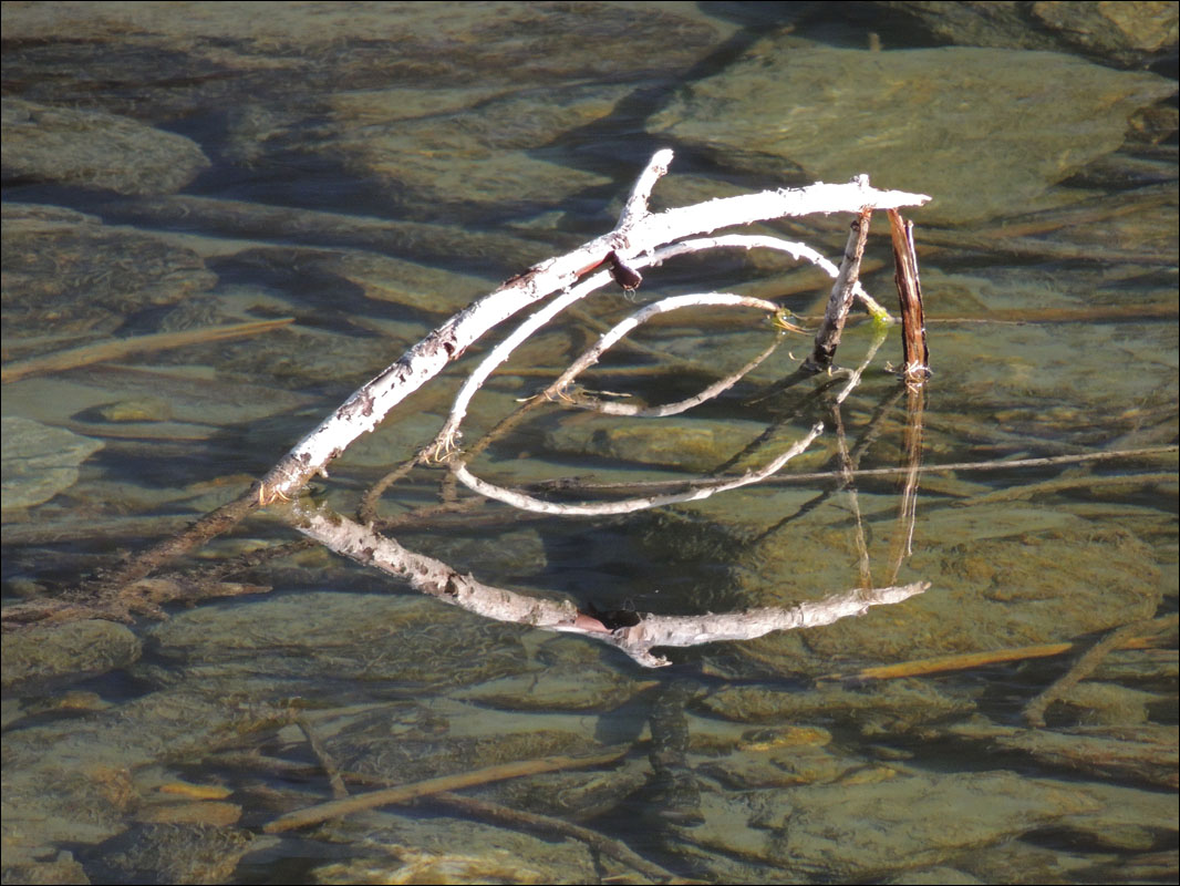
Bei Lago d Arpy sind wir von den herrlichen Spiegelungen im klaren Wasser hingerissen.
|
In Lago d'Arpy, we are enchanted by beautiful reflections in the clear water.
|
|
|
|
|
|
|
|
|
|
Wie oben erwähnt, haben wir in 2009 den Mont Blanc besichtigt. Angefangen in Chamonix auf der Nordseite nahmen wir die Seilbahn zur Aiguille du Midi und bekamen einen herrlichen Ausblick auf den Berg. (Link zu unserem Bericht).
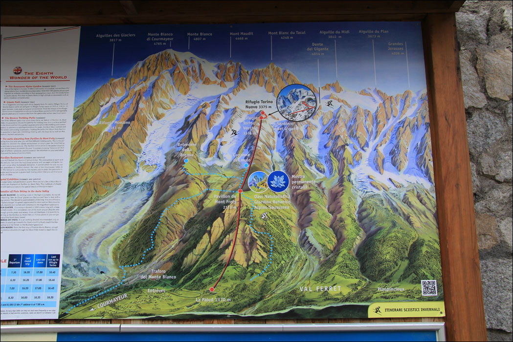
Jetzt zum Abschluss unsere Italien-Tour wollen wir von Entrèves aus die Seilbahn zum Rifugio Torino Nuovo (3375m) nehmen und diesmal das Mont Blanc Massiv von der Südseite sehen. Allerdings werden wir an der Seilbahn gewarnt, dass es oben bewölkt ist.
|
As mentioned above, in 2009 we visited Mont Blanc starting from Chamonix on the north side. We took the cable car to the Aiguille du Midi and had a great view of the mountain. (Link to our report).
Now to complete our Italian tour we want to take the cable car from Entrèves up to the Rifugio Torino Nuovo (3375m) and see the Mont Blanc massif from the south side. However we are warned at the cable car ticket office that it is cloudy at the top.
|
|
|
|
|
|
|
|
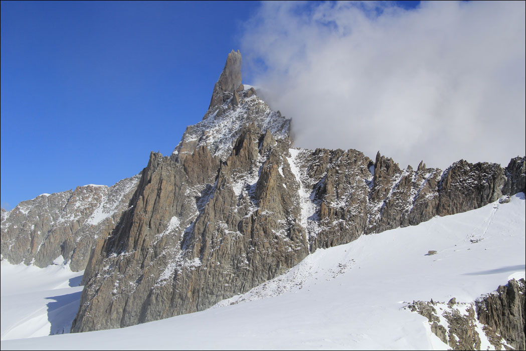
Von oben bekommen wir zwischen den Wolken einen guten Blick auf den Dent du Géant (4013m, Zahn des Riesen) in ca. 2,5 km Entfernung, Bild oben.
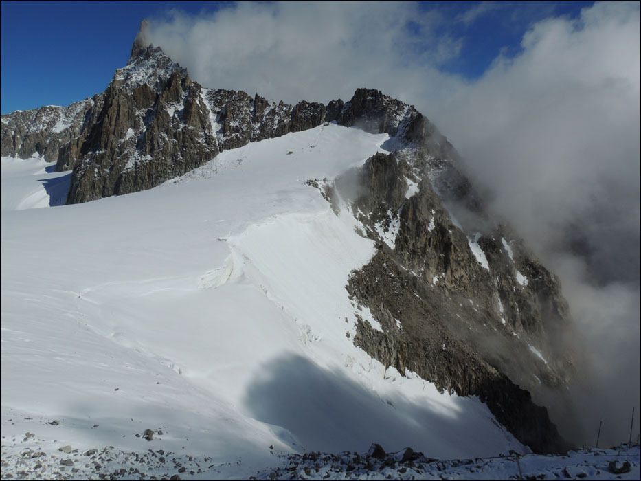
Etwas weiter rechts, oberhalb des Gletchers des Riesen, sieht man die dunke Aiguille (Nadel) de Rochefort, 4001m.
|
At the top the clouds clear a bit and give us a good look at the Dent du Geant - the 'Giant's Tooth', which is 4013m high and about 2,5 km away, (above).
A little further to the right, (picture below), above the Giants Glacier is the dark Aiguille ('needle') de Rochefort, 4001m.
|
|
|
|
|
|
|
|
|
|
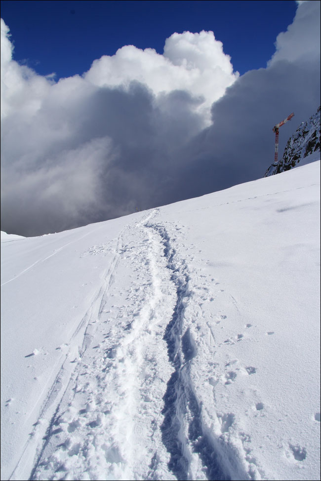
Wir sind nicht für eine Schneewanderung ausgerüstet. Ich laufe nur einige hundert Meter in Richtung Norden von der oberen Station, um einen Panoramablick zu bekommen.
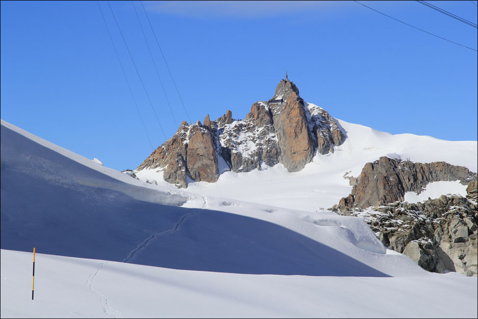
Der Dent du Géant (rechts) ist wieder von Wolken bedeckt, aber jetzt sieht man geradeaus in einer Entfernung von ca. 5,5 km leicht rechts von den Spuren im Schnee die Aiguille du Midi, 3842m.
Das nächste Bild unten zeigt die Aiguille du Midi herangezoomt. Jetzt ist der Radioturm auf der Nadelspitze auch sichtbar.
Siehe Link für ein weiteres Bild dieser beindruckenden Nadelspitze aus der Nähe von unserem früherem Trip.
|
We are not equipped for a snow hike. I walk a few hundred meters to the north from the upper station to get to where there is a fine panoramic view.
The Dent du Géant (right) is covered by clouds again, but now straight ahead at a distance of about 5.5 km, (slightly to the right of the tracks in the snow), Aiguille du Midi (3842m) is in sight.
In the next picture below I zoom in on the Aiguille du Midi. Now the radio tower on the needle point can be seen as well.
See link for one more picture of this impressive needle tip seen closer up on our previous trip.
|
|
|
|
|
|
|
|
Ich stapfe auf dem Schneepfad am Col du Geant zurück zur Station.
Dicke Wolken belagern weiterhin die Südseite des Bergmassivs.
|
|
I trudge back to the station on the snow path across the Col du Geant.
Thick clouds continue to besiege the south side of the mountain.
|
|
|
|
|
|
|
|
|
|
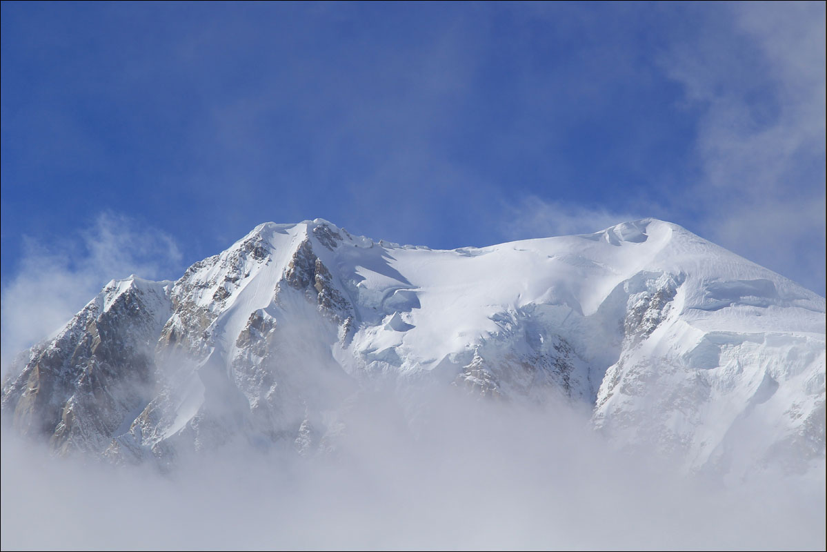
Zurück an der Station heben sich glücklicherweise die Wolken für eine relativ kurze Zeit und wir bekommen doch den grandiosen Mont Blanc mit seinen stolzen 4810m zu sehen.
|
Back at the cable car station we are fortunate that the clouds lift for a moment to give us brief view of the magnificent Mont Blanc itself with its proud 4810m.
|
|
|
|
|
|
|
|
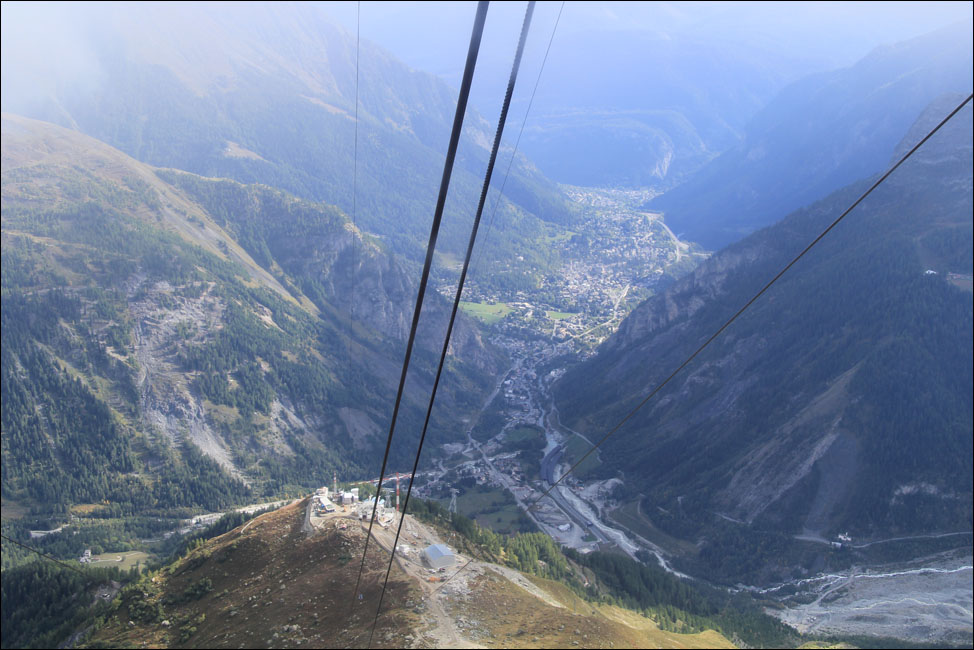
Wir schauen noch einiges in der Gegend an, aber mit der Seilbahn-Abfahrt hinunter zum Aostatal fängt unsere eigentliche Rückreise nach Süddeutschland nach einer unerwartet abwechslungsreichen Tour in Italien an.
|
We visit a few more places in the area but the cable car ride down into the Aosta Valley is really the start of our return trip to southern Germany after an unexpectedly varied tour in Italy.
|
|
|
|
|
|
|